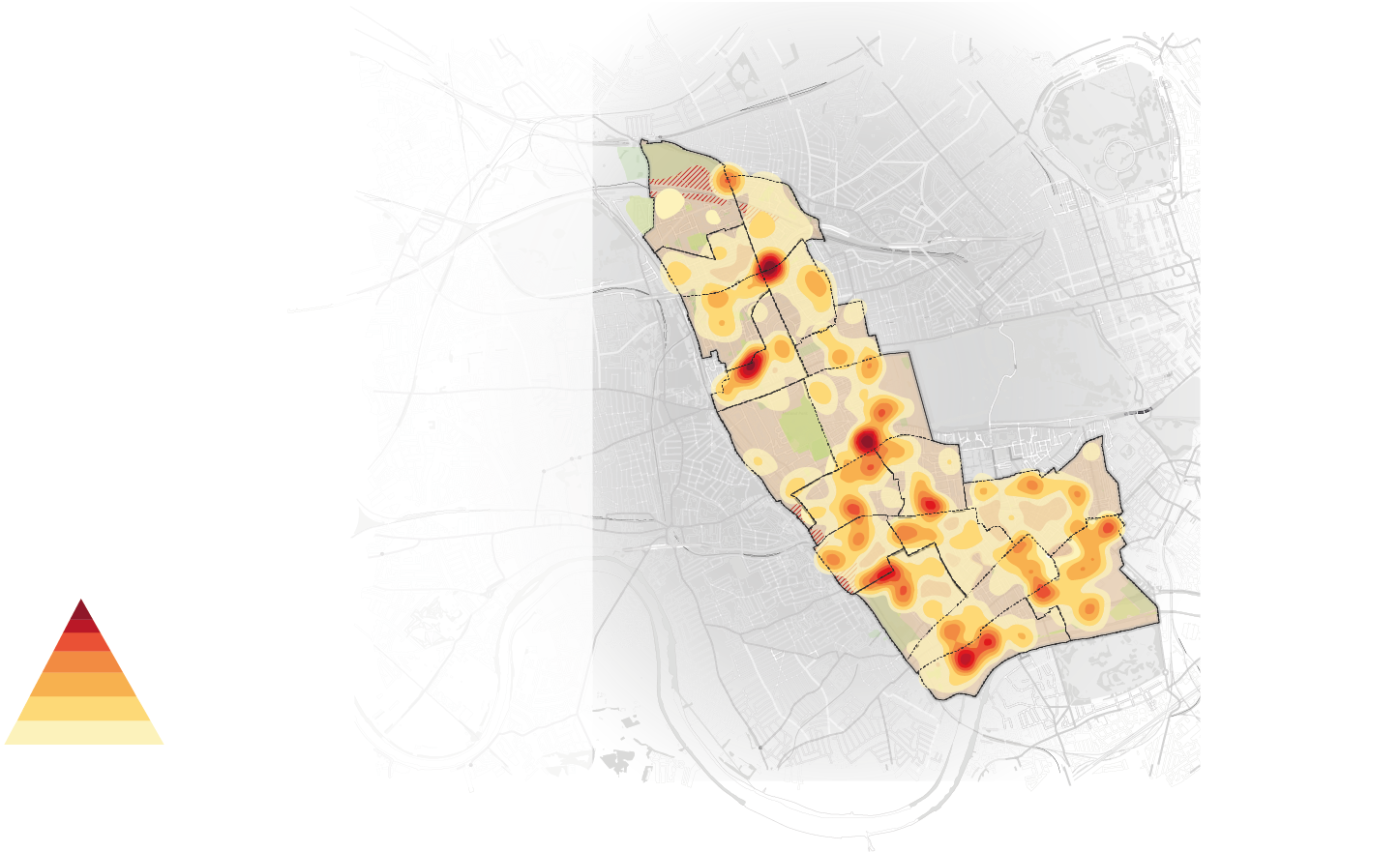
Whilst I worked with the Royal borough of Kensington and Chelsea, I collated data sets from across different departments and using QGIS software, I documented which wards had higher provisions of community facilities. This was in the aims of creating a master database of information for the council and inturn the public to understand where community spaces were accessible.